California news

Historic map of American Southwest showing proposed railroad routes, southwestern topography, and wagon trail taken by surveyors in the Territory of New Mexico. Bold yellow text indicates the location, “Territory of New Mexico '', while small italicized black text represents indigenous tribes in the region like the Pah Utahs, Mohaves, Tontos, and Cosninas. Mountain ranges and high topography is represented by green areas with hatch marks reflecting elevation. The proposed railroad routes are in purple.

Map of the Month: September 2022

Our September Map of the Month is this mid-1800s map exploring the feasibility of constructing a trans-continental railroad route through Arizona. The full title is “Explorations and Surveys for a Rai...
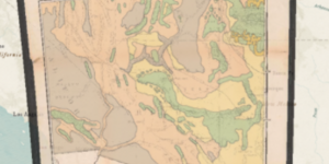
Picture showing a digital copy of the original vegetation map overlaid in its' actual geographic location in the US.

New Web App: Western North America Vegetation and Locust Map

Our latest web app, Western North America Vegetation and Locust Map, is now live and available to the public. ...

A portion of the “Carte De La California” historic map depicting sections of all 5 historically significant cartographic changes in representing California. Each different map is separated by a thick black border. The interior of each section is a map of California, labeled “Californie”, and its major cities at the time which each segment was drafted.

Map of the Month: April 2022

Our April Map of the Month is titled “Carte de la Californie” and compares five recreations of historically significant maps of California to show the evolution of cartographic knowledge of the region...