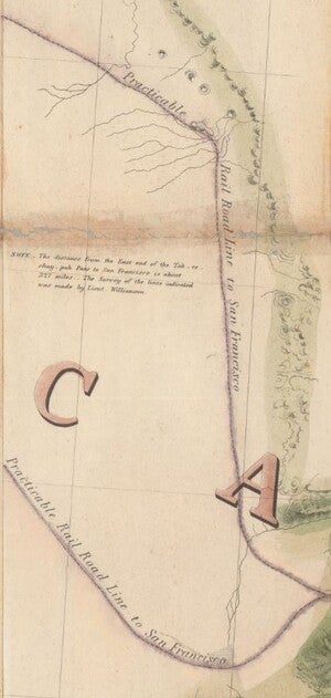
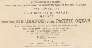
Our September Map of the Month is this mid-1800s map exploring the feasibility of constructing a trans-continental railroad route through Arizona. The full title is “Explorations and Surveys for a Rail Road Route from the Mississippi River to the Pacific Ocean, Route Near the 35th Parallel, Map No. 2. From the Rio Grande to the Pacific Ocean.” For the sake of simplicity, we call it “Explorations and Surveys for a Rail Road to the Pacific.” This map is one of a multitude of series that were produced during the Pacific Railroad Surveys, depicting the routes surveyors took, their proposed rail lines, and detailed topographic illustrations of the landmarks and features they came across.

The Pacific Railroad Surveys were conducted from 1853-1855. A total of five surveys were funded by Congress under the ultimate direction of Jefferson Davis, the Secretary of War. While the main goal of the surveys was to determine potential routes for constructing a trans-continental railroad, the surveyors also endeavored to study and document everything they saw and interacted with. When the final maps and reports of the surveys were published by the U.S. War Department, it became apparent that the addition of scientists and artists to the expeditions had resulted in highly comprehensive surveys of geology, natural history, ethnography, and botany of the American West. This particular map is a representation of one of two Southern Pacific railroad surveys, running mainly along the 35th parallel from Oklahoma to California with occasional movement south along rivers like the Colorado.
The early to mid-1800s marked a period of Westward Expansion and growing interest in technological development on the frontier. As more and more Americans moved to the Western territories, the need and demand for a railroad to connect the east and west halves of the country grew. The surveyors of the Pacific Railroad Surveys were sent to propose the best possible routes for a rail line through the respective parts of the territory that each group covered, ideally resulting in several good options that the U.S. government could use to plan an optimal route. The main proposed route on this map runs from near Albuquerque across what is now the northern parts of New Mexico and Arizona across the Colorado River and into Southern California. There are several smaller proposed lines that branch from the main route, like the two that branch off south of the San Francisco Mountains and run south to the Rio Salinas and Rio Gila.
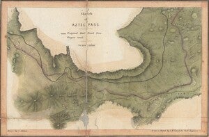
This map also includes detailed insets of Aztec Pass and Campbell’s Pass that more clearly illustrate the exact proposed rail line and where it would fall among the passes’ topography. The relatively narrow Aztec Pass in particular requires this level of detail as the surveyors were proposing a route with several large curves and one rather sharp turn. These insets would have been particularly useful pieces of information for the officials tasked with planning the supplies and costs of constructing the railroad as a narrow enough pass could require modifications like narrow gauge rail (read more about narrow gauge rail and its use in American railroads in our June 2022 Map of the Month).
The Pacific Railroad Surveys concluded in 1855 and the various maps, illustrations, and reports created by the surveyors were published throughout the next several years. The information collected in the surveys as well as factors like the economic impacts of the California Gold Rush and the start of the Civil War collectively persuaded the United States government to begin construction of a trans-continental railroad. In 1863, construction began on the Pacific Railroad (also known as the Overland Route) and by 1869, the 1,911 mile railroad opened to passengers as the first trans-continental railroad in the nation’s history. Although the Pacific Railroad was too far north to incorporate any of the proposed routes depicted on this map, several later railroads did follow this proposal, such as the trans-continental Atlantic and Pacific Railroad and some parts of the Denver and Rio Grande System. Between the proposed routes and dozens of naturalistic and scientific discoveries, the findings of this survey greatly impacted the future of the nation.
We hope you enjoyed this month's map! As with all of our Map of the Month features, if you’d like to learn more about this map, get a scan of this map, or schedule a visit to explore our maps in person, please submit a Map and Geo Service Request. We’ll be sure to get back to you within two business days, but typically sooner.
- Kelsey Kerley, Map and GIS Assistant


