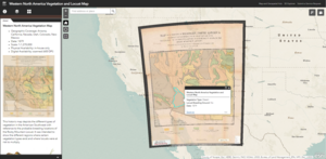
Our latest web app, Western North America Vegetation and Locust Map, is now live and available to the public.

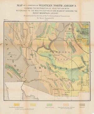
Henry Gannett, U.S. Entomological Commission, 1879
- Geographic Coverage: Arizona, California, Nevada, Utah, Colorado, New Mexico
- Date: 1879
- Scale: 1:1,270,000
- Physical Availability: in-house only
- Digital Availability: scanned (600 DPI)
This web app features our unique 1879 Western North America Vegetation and Locust Map. This historic map illustrates the different types of vegetation across the Western U.S. and identifies areas at risk for an infestation of the Rocky Mountain Locust.
This app is designed to help differentiate and identify the different regions and their identified vegetation type and locust risk, making it easier to interpret the data. Each selectable polygon is paired with a pop-up box that includes information on the area’s specific vegetation type and risk for a locust infestation. Each polygon matches the coloring of the original map which is available to view alongside the digital version in the app.
This map can be utilized in conjunction with modern maps to identify the ecological changes that have occurred in the American Southwest since the late-1800s. In addition to the ecological uses of this map, the data is also applicable to other fields such as climatology and hydrology.
We hope you enjoy exploring the data available in our newest web app! If you would like to request a high-resolution scan of the original 1879 map or are interested in viewing the collection in person, please submit a Service Request to the Map and Geospatial Hub. Be sure to follow our Facebook page for the latest Map and Geospatial Hub updates!
-Giovanni Catanzaro, Map and GIS Assistant
