Tempe, Arizona
Tempe Chamber of Commerce
1962
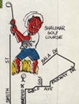
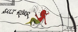
Through the years, the ASU mascot, Sparky the sun devil, has gone through significant changes in his appearance. This Tempe map from 1962 takes a humorous approach to Sparky, showing him in many different recreations and professions. From cowboy to golfer to mer-devil, Sparky draws attention to professions and sites around Tempe. Knoell Homes likely wanted to draw attention to the town and their houses under construction.


In addition to the illustrations, this map also shows several sites that no longer exist. Next to the Salt River, pre Tempe Town Lake, you can see Tempe Beach Park. Further north is Tempe’s own theme park, Legend City, demolished in 1983. The “future site” of several local schools are labeled, likely to accommodate the growth of additional neighborhoods as advertised. Notice that Baseline Road marks the Tempe city limit. This map and many others in our collection show the changes to ASU, Tempe, and the greater Phoenix metro area over time.
by Karina Wilhelm