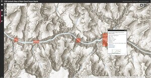
Our latest web index, 1988 Hydraulic Maps of Major Grand Canyon Rapids, is now live and available to the public.

- Geographic Coverage: Arizona
- Date: 1988
- Scale: 1:1,000
- Physical Availability: in-house only
- Digital Availability: scanned (600 dpi)
This application depicts the extent of ten major rapid maps. Each rapid can be seen at a variety of water levels, measured in cubic feet per second. The purpose of these maps is to characterize the hydrological features of the Colorado River at these major rapids.

The online index puts these ten maps into their proper geographical contexts, illustrating both exactly where these Colorado River rapids are located, and, more importantly, how the river is dramatically altered at varying water flow rates.
Within the application, one may easily move between the rapids with the bookmark tool as they may be difficult to locate due to the large breadth of the depicted locations and the small size of the rapids.
If you’d like to access high resolution images of these infographic maps, please make a Map/Geo Service Request and we’ll be sure to get back to you within two business days, but typically sooner.
-Grace Bahen, Map and GIS Assistant