In 1898, Cuba was in the midst of a bloody war for independence from Spain that had been raging for three years. American public opinion swayed dramatically towards support through the 1890s, especially with American journalists fully embracing Yellow Journalism to exaggerate and embellish the atrocities Spain was committing in Cuba. These tensions finally boiled over on February 15, when the American pre-dreadnought battleship USS Maine mysteriously exploded and sank within Havana harbor. Next month, the United States declared war on Spain to assist Cuba in its yearslong efforts for independence. The Spanish-American War had begun.
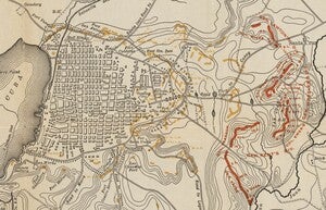
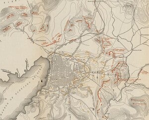
This month, we’re looking at a pair of maps that represent the positions of the U.S. Army’s Fifth Corps during the siege of Cuba’s second largest city, Santiago de Cuba, on two dates: the day of the truce, and the day the Spanish surrendered. The names of regiments and their commanding officers can be seen.
The first map represents the day of the truce, July 3rd.
The second map is from the day of surrender, July 14th.
The American position was strengthened as it received significant reinforcements. Additional US Army troops arrived as well as Cuban Revolutionary units, which surrounded Santiago from the north.
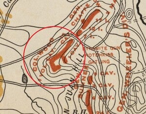
Perhaps one of the most famous military units in American military history played a role during the invasion of Cuba: the 1st United States Volunteer Cavalry Regiment, an all-volunteer force formed in 1898 specifically for the Spanish-American War. That cavalry regiment was nicknamed the ‘Rough Riders’, and is the regiment that then-future President of the United States, Theodore Roosevelt, served with during the Spanish-American war. In fact, the position of that regiment can be seen on both maps.
We hope you enjoyed this month's map! As with all of our Map of the Month features, if you’d like to learn more about this map, get a scan of this map, or schedule a visit to explore our maps in person, please submit a Map and Geo Service Request. We’ll be sure to get back to you within two business days, but typically sooner.
- Eric Friesenhahn, Map and GIS Specialist


