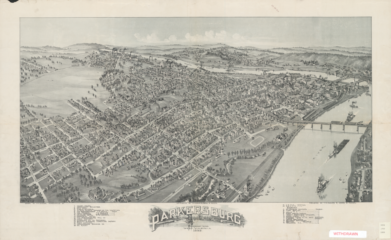
Founded just after the Revolutionary War, the city of Parkersburg was settled at the confluence of the Ohio and Little Kanawha rivers in West Virginia. Originally called Newport, the town’s name was changed in 1810 in honor of one of the city’s owners, Alexander Parker. Settled primarily by New Englanders, Parkersburg grew swiftly, becoming one of the largest in the state by 1900. This Map of the Month for March 2025 is a bird’s eye view of the town of Parkersburg West Virginia at the turn of the 20th century.
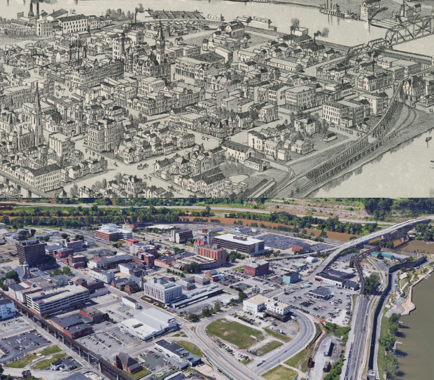
Like many American cities, the center of the town once looked much different. In what was once a bustling downtown of a small city, there now lies parking lots and garages, empty lots, short, sprawling buildings, gas stations and a few bank towers. Large exposed brick walls, emblazoned with ads, face parking lots where neighboring buildings once stood. The few buildings that remain from the older periods are commonly derelict and often in disrepair.
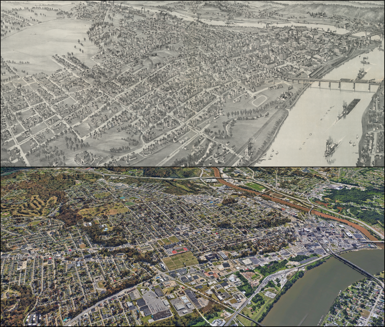
The town center once contained many residential buildings and the associated businesses and community centers. It even had a streetcar system to aid in moving this central population around the area. Most of the residential buildings and the streetcar have been demolished, however, to make room for freeway access, and parking.
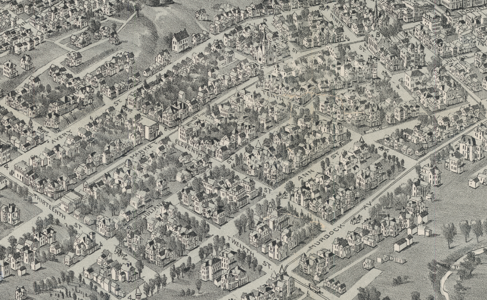
While much of the historic downtown was gradually demolished and lost, the town has put great effort into preserving the history of its less urban areas with a significant portion of the 19th century suburban homes preserved in the Julia-Ann Square Historic District. Many of the buildings standing there today are featured on the map, having been built in the 19th century.
We hope you enjoyed our March 2025 Map of the Month!
- Title: Parkersburg West Virginia
- Date: 1899
- Author: T.M. Fowler
- Publisher: T.M. Fowler & James B. Moyer
As with all of our Map of the Month features, if you’d like to learn more about this map or schedule a visit to explore our maps in person, please submit a Map and Geo Service Request. We’ll be sure to get back to you within two business days, but typically sooner.
-Grace Behan, Map and GIS Assistant