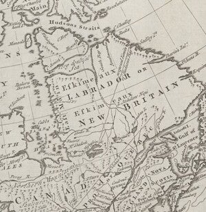
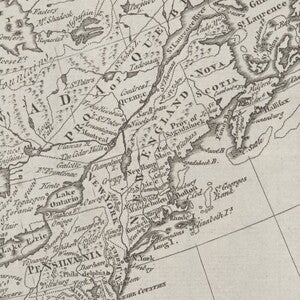
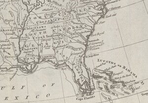
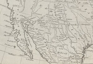
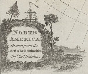
Happy New Year! Our January Map of the Month is this map titled “North America Drawn from the Latest and Best Authorities” that is believed to be from the 1780s. It was made by Thomas Kitchin, an English cartographer and engraver, and displays the entirety of the North American continent as had been mapped by the late 1700s, featuring the most detail on the East Coast American and Canadian territories.
The exact publication date of this map is unclear as several versions of it exist and are attributed different dates of publication. The majority of publicly available copies of this map list its publication date as being in the late 1780s (typically 1787) though there are some versions of it dated as early as 1770. While the exact date is not clear, the map was most likely created during or shortly after the Revolutionary War as it shows the new borders and British claims on Canada that followed the French and Indian War but does not show the designation of new states like Vermont that occurred in the 1890s.
The depiction of Canada on this map shows an interesting mix of French influence coexisting with British authority. This cultural blend came as a result of the French and Indian War. The French and Indian War lasted from 1754-1763 and was a conflict between the French and British colonies of North America. When the war ended, Britain gained control of French Canada and imposed its own government over the French colonists who chose to remain in the territory. Approximately 80,000 French colonists chose to stay (primarily in the Province of Quebec) despite the transition to British rule and Britain’s implementation of new names for parts of the territory like New North and South Wales. The presence of these French colonists is responsible for the prominence of French language and culture that still exists in Canada. Their presence also led New England to conduct several military expeditions to Canada in an attempt to convince them to join their revolt against Great Britain near the beginning of the Revolutionary War.
Revolutionary Era New England as shown on this map is quite different from the New England of today. The states of Connecticut, Rhode Island, and Massachusetts are all similar to their modern counterparts’ shape and placement, but New Hampshire, Vermont, and Maine are drastically different. At the time of the Revolution, New Hampshire was the only one of these states to be an official colony while the other two were still territories claimed by different colonies. The land that would become Vermont was under claim by both its neighbors (New Hampshire and New York) and the small region labeled “Province of Maine” was considered part of Massachusetts. Although much of New England was unsettled territory at this time, it was still the site of several key points of the early Revolutionary War, including many expeditions to Canada and the Burning of Falmouth in 1775. British naval forces bombarded the town of Falmouth (modern Portland, Maine) for several hours before sending a landing party ashore to ensure the decimation of the town in retaliation for the early rebellious actions of Massachusetts. The response of the colonists was one of outrage, and this outrage spurned Congress to speed up its organization of an American Navy and strengthened the cries for all-out revolution throughout the colonies.
The southern states on this map are a bit more recognizable along the Atlantic coast, but they extend much further into the continent’s interior than they do in the present. On this map, North Carolina extends to include the territory that would become Tennessee while South Carolina and Georgia encompass most of present day Alabama and Mississippi in addition to their own territories. The reason for these strangely long territories can be traced back to early American colonialism. New colonies established charters that, among other things, established their claims to various territories. These territories typically started at the coastal area the colonists had landed on and extended deeper into the continent. As more colonies were established, many rewrote their original charters to claim land deeper into the continent, creating borders like those shown on the map.
The immense detail on the eastern portion of this map diminishes steadily across the continent toward the West Coast. The central and western regions of Canada and the Pacific Northwest were largely unexplored at this time and therefore show only the paths of large rivers, placements of mountain ranges, and even a note that reads “These Parts are unknown”. The Southwest had been explored more a bit thoroughly by Spain at this time and while there is more detail shown in this region, it likely does not match that of the Atlantic coast because the region labeled “New Mexico” on this map was near the northern edge of Spanish territory, so it had far fewer occupants and explorations than the southern parts of the territory.
We hope you enjoyed this month's map! As with all of our Map of the Month features, if you’d like to learn more about this map, get a scan of this map, or schedule a visit to explore our maps in person, please submit a Map and Geo Service Request. We’ll be sure to get back to you within two business days, but typically sooner.
- Kelsey Kerley, Map and GIS Assistant

