The Map and Geospatial Hub is pleased to announce a new digital map exhibit:
Visualizing the Survey: Plans and Profiles of the Colorado River
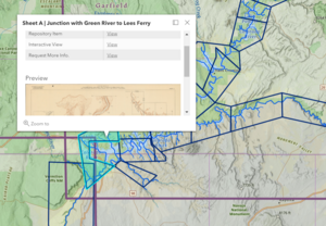
Visualizing the Survey is a dynamic multimedia exhibit visually describing, explaining, and celebrating an historic collection of maps and charts: Plans and Profiles of the Colorado River.
The collection reflects the output of multiple Colorado River surveys conducted by the USGS between 1902 and 1923. Visualizing the Survey visually dissects the mechanics of the technical, but beautiful, survey sheets while contextualizing their historical and geographical significance.
Visualizing the Survey also improves the ease of accessing the newly digitized Plans and Profiles of the Colorado River collection by offering a new interactive web map linking directly to multiple view and download options via ASU Library.
This project is the product of a collaborative, team effort by staff at the ASU Library Map and Geospatial Hub, with Remi Tuijl-Goode serving as Production Lead and Matthew Toro serving as Project Director.
Check out and share Visualizing the Survey: Plans and Profiles of the Colorado River!


