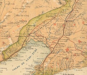
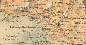
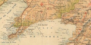
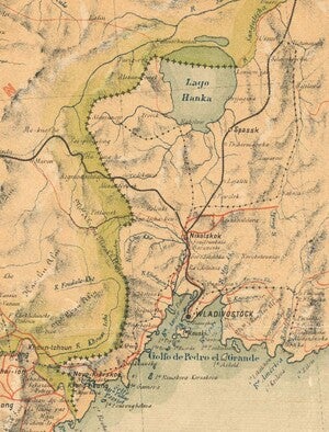
Our October Map of the Month is this undated Spanish map titled “Corea y Sur de Mandchuria” (Korea and South Manchuria). It depicts the Korean Peninsula and Southern Manchuria just prior to the start of the Russo-Japanese War, before Japanese occupation and the Division of Korea. It includes various details like locations of mountain ranges and markers of the roads and telegraph lines that run throughout the territories.
The Russo-Japanese War occurred from February 1904 to September 1905 and was a conflict between the Russian and Japanese Empires over control of Korea and Manchuria. Both the established imperial power of Russia and the rising power of Japan had an interest in establishing spheres of influences in this territory. Russia had a long history of westward expansion and attempts to establish warm-water ports in its empire, which could be done if it took the Korean Peninsula. Meanwhile, Japan had intentions to expand and conquer parts of mainland Asia and believed that Russian expansion into Korea would be an obstacle to this goal. The nations attempted to negotiate for a time before the negotiations came to a halt due to both sides refusing to compromise on the issue. On February 9, 1904, Japanese naval ships attacked the Russian Fleet and the war that would set the stage for many global events and political relationships of the 20th century began.
Even before its conclusion drastically altered the future of the Eastern Hemisphere, the Russo-Japanese War drew a great deal of international interest, particularly from European nations. It was an instance of the classic East vs. West dichotomy, but for the first time the Eastern nation was uniquely positioned to be an equal adversary to an established Western nation. This unprecedented dynamic between Russia and Japan at the outbreak of the war likely explains Spain’s interest in the war and its decision to have its War Depot (denoted on this map as “Talleres del Depósito de la Guerra”) survey and map the contested territories.
In addition to depicting the various borders and topography of the region, this map depicts areas and elements that would be significant in the war. This includes documentation of important cities like Seoul (labeled “Seul” on this map) as well as mapping industrial commodities telegraph lines that run throughout both Korea and Manchuria and Korea’s singular rail line that runs from Seoul to the Yellow Sea. Given that this map focuses mainly on the contested territory of Korea and Manchuria with little inclusion of Russian or Japanese territory, it is likely that this map was made to develop Spanish knowledge of that territory.
This map includes the sites of what would eventually be crucial battlefields of the war, such as Port Arthur. The Battle of Port Arthur was the battle that started the Russo-Japanese War when Japanese forces attacked the Russian fleet housed in Port Arthur. It was also the longest battle of the war, lasting for months as Russian forces scrambled to defend their hold on the area while Japanese forces slowly but surely wore them down through devastating bombardment both from ship artillery and land-based artillery. By the time the battle ended in January 1905, all of Russia’s most valuable battleships and cruisers had been sunk and the Japanese had gained a great deal of strategic land that was making their attacks more detrimental to Russian forces with each passing day. The battle ended with the surrender of Russian forces, allowing Japan to take Port Arthur and thoroughly demoralizing Russian troops across the board.
Japanese forces continued to overpower the Russians for the remainder of the war and on September 5, 1905, the Russo-Japanese War came to an end with the ratification of the Treaty of Portsmouth. Japan’s impressive and complete victory over the Russians shocked the world; never before had an Eastern nation so easily defeated a historic powerhouse like Russia. It upended the existing East-West power balance and established Japan as not only the victor of this conflict but as the dominant power in the Eastern Hemisphere. The embarrassing defeat Russia experienced in this war was a primary factor in sparking the First Russian Revolution in 1905 which foreshadowed the Russian Revolution of 1917, where the Russian monarchy was overturned and communist rule established. Despite undoubtedly winning the war, the Japanese populace were not happy with the terms of the treaty negotiation, which in turn led to the Hibiya Riots and the eventual collapse of Katsura Taro’s regime. Thus, the outcome of the Russo-Japanese War laid the foundation for pinnacle events of the 20th century like extreme Japanese nationalism and expansionist policies, Japanese invasion and occupation of Korea and Manchuria, and more.
We hope you enjoyed this month's map!
As with all of our Map of the Month features, if you’d like to learn more about this map, get a scan of this map, or schedule a visit to explore our maps in person, please submit a Map and Geo Service Request. We’ll be sure to get back to you within two business days, but typically sooner.
- Kelsey Kerley, Map and GIS Assistant


